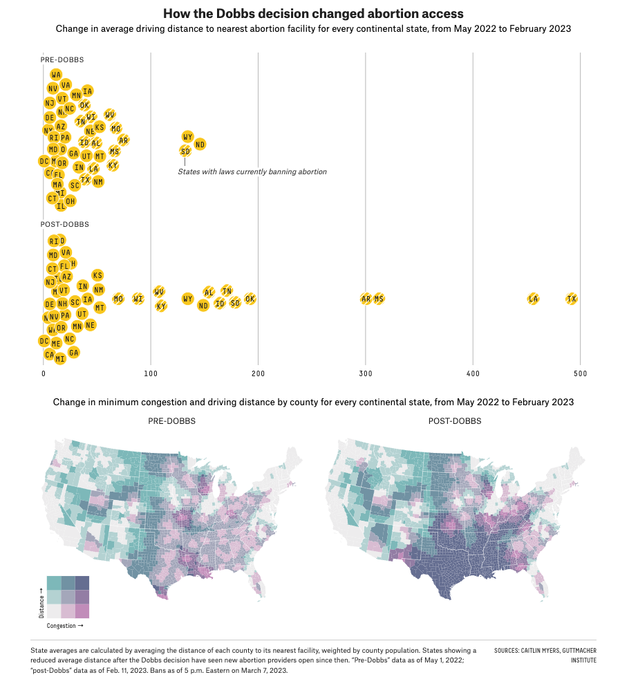
In the wake of the 2022 Supreme Court decision in Dobbs, some states banned abortion immediately, while others were expected to do so during their 2023 legislative sessions. We used data from a researcher to create an interactive that showed users how distance and congestion — the number of people living closest to a provider — would be affected as these bans became law.
The map uses a bivariate scale to show the impact of bans on both distance and congestion at the same time and users can click buttons above the map to toggle bans on and off (we gave only a subset of states as options here).

We created further visualizations to show the change at the state level and a before/after comparison as well.